Earthquakes
This first image is a map of Washington and Oregon earthquakes
recorded by the Pacific Northwest Siesmic Network since installation
in early 1969. Quakes are color coded by largest magnitude at a
given location:
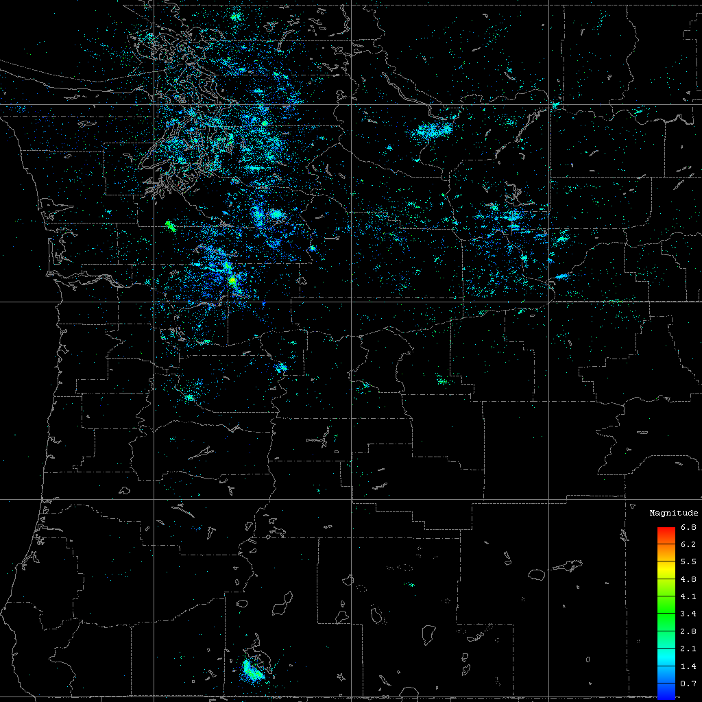
Notice the bright spot near the bottom to the left of center ? This
is Kalamath falls.
Next is the cross-section view. Quakes in this image are color
coded as above, by magnitude:
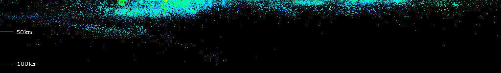
Horizontal scale and vertical scale are the same, so the image is
about 777km left-to-right. Color coding is the same as in the first
image, largest magnitude at a given point.
Here's the same data, but this time color coded by depth:
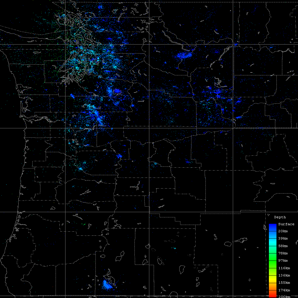
Notice the red cluster in the cross-section image below, then find it
in the image above.
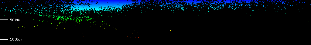
The green to red swath on the left side of the image between 30km
and 100km in depth is the Juan de Fuca plate, profiled by the
earthquakes it causes as it slips under the North American plate.
The Juan de Fuca plate moves at a rate of about 3cm/yr with respect
to the North American Plate.
Webliography
Data was obtained from the Pacific Northwest Siesmic Network
covering the period from 19690214 through 20010301 available at
ftp://ftp.geophys.washington.edu/pub/seis_net/
The latitude of this image ranges from 42N to 49N, while the
longitude ranges from 117.5W to 124.5W. I've discarded all data
ouside this range, all catalog entries with magnitude of zero or
less, as well as those for which magnitude and depth is not provided
(you have to see the catalogs).
Map taken from
Xerox PARC Map Viewer
. The actual query used is:
http://mapweb.parc.xerox.com/map/db=usa/iwd=1024/iht=1024/lat=45.5/lon=-121/proj=rect/wd=7/ht=7
.
More about the
Juan de Fuca plate
.
20010304